Cancer Research UK Walk 2008
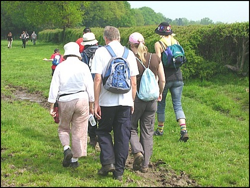
Lapworth/Kingswood is a lovely location about 10 mile from Warwick and at the junction of the Stratford on Avon and Grand Union Canals and, as it offered various walk possibilities, it was decided to have a figure of eight walk with the half way point, for midday refreshments, being the Village Hall. Not only did this help with the catering but also made it easier for those walkers who were only able to do half of the walk, which this year was approximately 12.5 miles in total length. Yes, as we get older they do seem to get shorter; but quality is more important than quantity and both the morning and the afternoon walks proved to be very enjoyable.
The enjoyment was also helped by a perfect day for walking. The sun was out all the day but thanks to slight cloud cover the temperature never became oppressive. The route details (in black) are below interspersed with comments, pictures etc.
The morning route visited Lapworth, Hockley Heath, Rowington, and Stratford on Avon Canal. The approximate distance being just over 6 miles.
The afternoon route visiting Baddesley Clinton, Rowington, and the Grand Union and Stratford on Avon Canals was also just over 6 miles.
Most of the early part of the morning route was easily identified by direction signs incorporating an oak leaf.
-o-O-o-
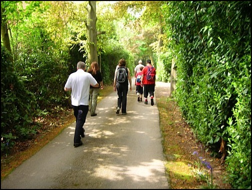
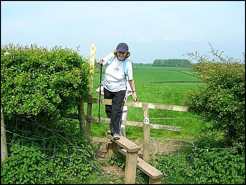
1. Leave Lapworth Village Hall, turn left and follow footpath along road. At Catesby Lane, path goes up an embankment before returning to lower level alongside road.
2. Soon, after road and path go round right hand bend, enter field via kissing gate on left – this is a few yards before the canal tow path. Walk through field with hedge on left until Sports Field is reached – Lapworth Cricket Club.
3. Cross sports field and go through kissing gate into field and continue ahead. Go over stile into next field, then downhill to gap in hedge at bottom left hand corner – pond can be seen on left.
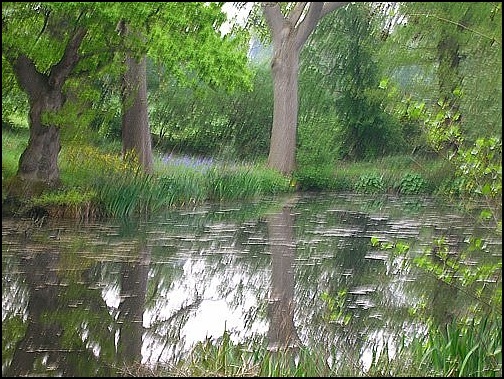
The Pond seen on our left.
A very tranquil place with bluebells on the far bank.
4. Follow path uphill, go over stile and follow track – hedge on right – to lane. Cross lane and take path on right towards Lapworth Church and follow this through churchyard to Church Lane.
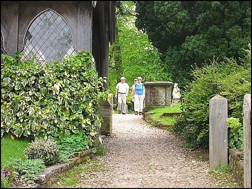
Walking through the churchyard at Lapworth Church. Although we
were using Lapworth Village Hall the Church is a mile or so away
from the main part of the village which has built up around the
junction of the Stratford on Avon and Grand Union Canals.
5. At lane turn right and immediately left into field. Follow path into second field which goes downhill and across stream – this area may be muddy. Follow track uphill, ignore marked path in left corner, and soon after will see path into field on left. Enter field and turn right and follow hedge until gate is reached. At this point path goes diagonally left across field to lane.
This was the only part of the walk where a navigation error could easily occur, as the marked path in the left corner was very obvious and inviting while the actual path required was less well marked and not so obvious.
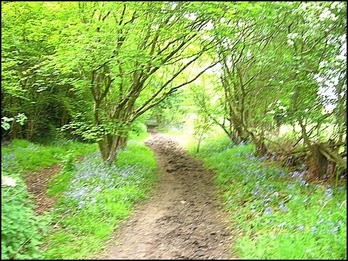
Looking back towards Lapworth Church. Note the abundance of buttercups.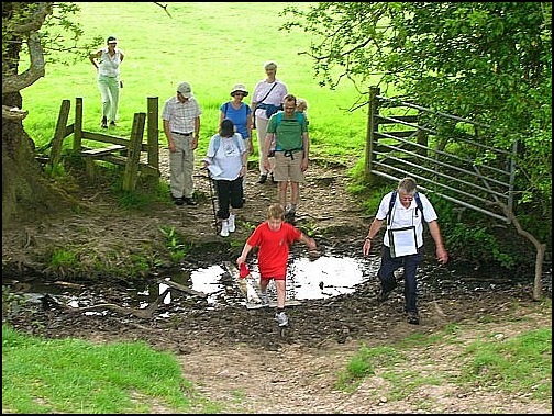
Following the rain the previous day the area by the stream was
muddy. Also some walkers were having a problem crossing the
stream but thanks to a piece of plank and a placement by Jeff the
problem was minimised.
6.At lane turn right and in a few yards take path left (opposite drive to house). Path goes right – between fence and hedge – into field. Here turn left and follow tracks to A3400. Turn left and before the 50 Sign is reached a footpath will be seen on opposite side of road.
7.Cross road and follow path, which soon crosses grassed area to gate. Turn right and follow track to right of house and soon pass through gap in hedge – on right – and into lane.
Along the lane to Nuthurst Grange.
8.Turn left in lane and follow until just before Nuthurst Grange is reached and take footpath on right. Cross diagonally over field and over two stiles before going down hill to lane. At this point M40 is very obvious. Cross lane and go along signed footpath until footbridge is reached. Cross footbridge and with hedge on right go uphill towards dilapidated barn.
Crossing the field to the dilapidated barn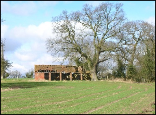
The dilapidated barn.
Photograph was taken in February. 2008 when the walk was planned.
9.Go to left of barn and across field to yellow marker post – keep obelisk to left.
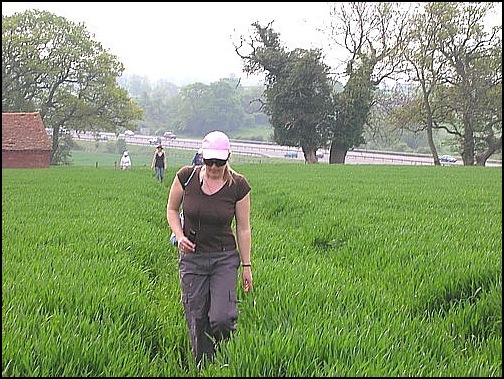
Crossing the field near the obelisk.
The dilapidated barn and the M40 can also be seen.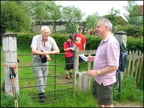
Ken, Richard & others having a break
in the lane beyond the Obelisk.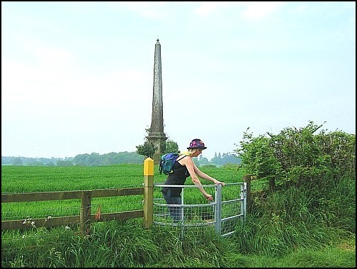
Dawn with the Obelisk beyond.
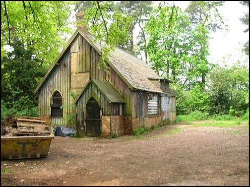
10.Cross lane and follow waymarked path. Note churchyard and dilapidated church on right. The next part of route is likely to be muddy as it is used by cattle.
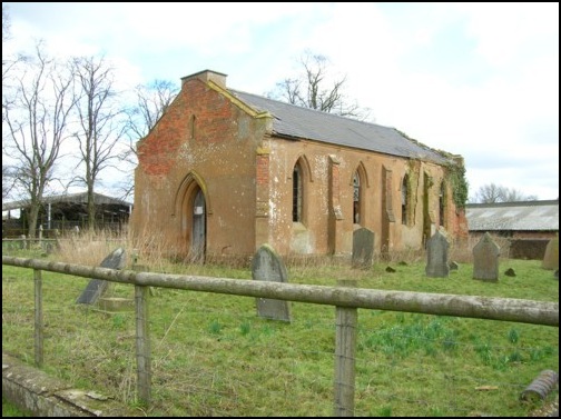
The dilapidated church. This photograph was taken in February.
During the walk the number of churches in the area was commented on. Was this, or is this, a very religious area?
11. Continue ahead towards another church that can be seen in the distance. Keep hedge on right. Enter churchyard and go to right of church to 'pick up' path, which soon becomes a wide metalled track after passing derelict wooden church building. Follow track to road and turn right to Hockley Heath.
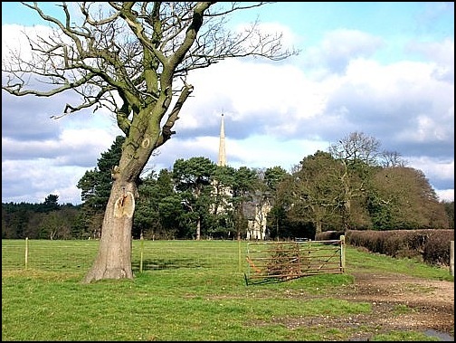
View of the next church also taken in February.
An unusual view. If anyone has a better caption please let me know.
The derelict wooden church building. I think most of the walkers found this unusual
and could have been out of the Blair Witch Project or a similar spooky film.
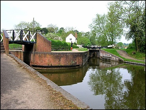
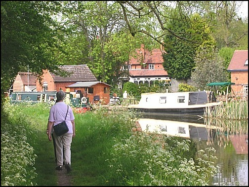
12. Cross road when footpath ends to footpath on other side of road and follow this around the left hand bend to road junction with A3400. Continue over canal bridge and left through car park of Wharf Inn to Stratford on Avon Canal.
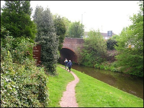
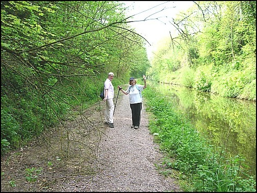
Paul and Dawn who I accompanied most of the way
along the canal at the beginning of the this part of the walk.
I was reminded later in the day that it is not always a good idea to trust the navigation of the person or group in front as although the instructions stated that you should 'turn left over the canal footbridge' one group decided to go right and a number of other walkers followed. Well that's one way of lengthening a walk!
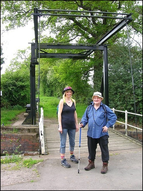
Dawn and Paul at one of the draw bridges found along
this part of the Stratford on Avon Canal.
13.Turn left over canal footbridge and follow canal for about 2 miles. At Bridge 33, located just past the Lapworth Marina, cross bridge and continue along the tow path until gap/gateway in hedge is reached – At this point tow path and road are only a few feet apart. Leave canal here, cross road with care, and turn left and in a few minutes you will be back at Lapworth Village Hall.
The map that covered the area of the morning walk was the OS Explorer map 220
The first walkers arrived back at Lapworth Village Hall shortly before 12.30 p.m. and sat down to enjoy the refreshments supplied by Lin, who was ably assisted by Joan. It certainly had been a pleasant stroll with an assortment of paths, views and an unexpected number of churches, and I was pleased to note that most walkers had found the instructions easy to follow.
To see a copy of the morning route that can be easily printed click here
Top of Page
Although I had intended to walk the afternoon route with Jeff I was delayed in 'getting away' so for the second walk I was accompanied by Christine and Annis, two of the regular walkers on these events. And very good company they were too.
The afternoon route visited Baddesley Clinton, Rowington, and the Grand Union and Stratford on Avon Canals and like the morning stroll was just over 6 miles in length.
1. Leave Lapworth Village Hall and follow the road right, towards the canal. Before reaching the canal turn right into Brome Hall Lane and immediately cross the road and go through the car parking area to the canal (Kingswood Basin) and turn right.
2.Cross the footbridge over the canal and continue alongside the basin to a second footbridge; cross this and turn left along the canal (This is the link canal between the Stratford on Avon and Grand Union Waterways).
A view looking back at of one of the footbridges
crossed at the Kingswood Junction
3.Follow the canal under the railway bridge and cross footbridge at the junction with the Grand Union Canal (Sign-posted Birmingham) and follow canal to Bridge 65 where canal is left.
4.Taking care (No footpath) cross road, turn right, and walk past Navigation Inn and house. Turn left down track marked with oak leaf sign and a sign for 'Train and Trek”, opposite gates to The Manor House. Follow track through gate into stable yard. Route goes to the right of the stable block.
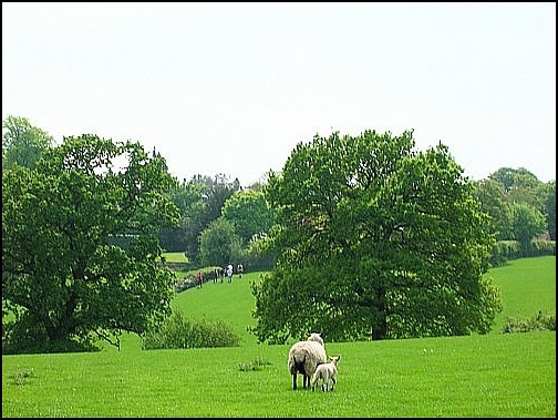
5.Go through gate and follow direction signs diagonally across the field heading for the far right hand corner. N.B. when checking on this route there were horses in the field but they took no interest in walkers, however, the entrance to the field was very muddy.
Although there was still mud just inside the field it was not as muddy as it was in February.
6.Enter 2nd field and follow hedge on right – obvious path – to 3rd field (Signed as being Baddesley Clinton National Trust Property). Enter field and initially continue with hedge on right until corner is reached. Turn corner, then go ½ left diagonally across field to driveway to Baddesley Clinton House. Turn right on drive and follow sign towards car park and house.
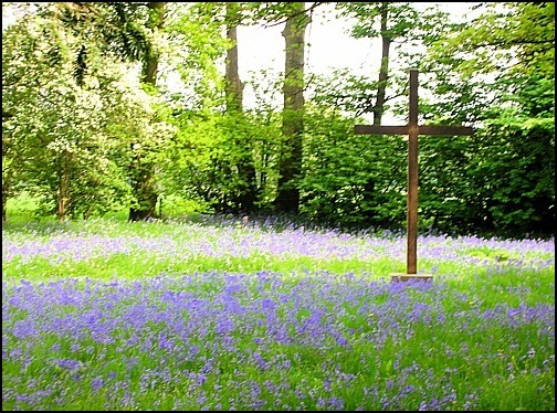
Bluebells in the churchyard at Baddesley Clinton.
During both walks bluebells were in abundance and probably at their best.
Another view of the bluebells in the
churchyard at Baddesley Clinton.
7.Go past car park (on left) and turn left along a path sign-posted 'to the Church'. Follow path which goes through churchyard and in a few feet take path on right sign-posted Heart of England Way. NB from here the Heart of England Way is followed to the Grand Union Canal.
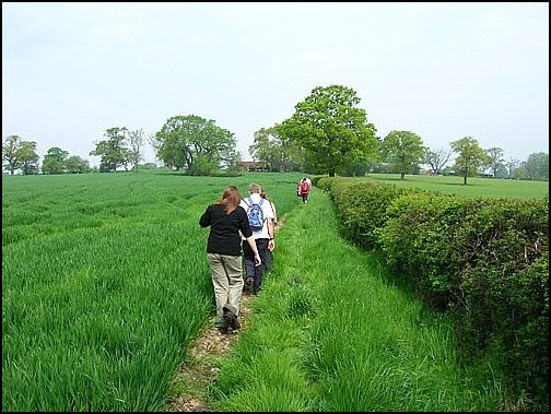
8.Continue to follow signs along field paths until a metalled track is reached. Go ahead along the track passing a farm on the right. Here the track becomes a rough path which leads to a road.
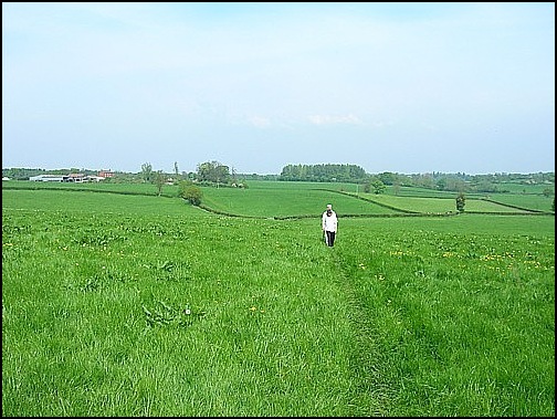
Warwickshire Countryside between
Baddesley Clinton and Rowington.
9.Turn left at the road (keep on right side to face oncoming traffic). Soon after passing a windmill conversion on the right, and opposite Green Farm, go right into field. Follow track between fence on left and tape on right (to separate walkers from horses). At end of field, to the right of gate, is a gap in hedge and kissing gate. Go through hedge and kissing gate and follow sign direction over hill to gap in hedge. (If the gap is not immediately noticed follow hedge to left)
This gap referred to above has now been filled by a gate, but as it was obviously new this did not cause any real navigational problem.
Annis, with big smile, crossing stile on the way to Rowington Church.
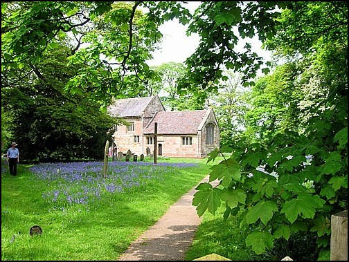
10.Follow signs continuing in same direction and soon, having gone up a slight hill, Rowington Church will be seen. Go past line of trees, downhill to gate, and then up hill with hedge on left. Near the top of ascent go left into another field and follow track to churchyard.
The above was not exactly true. When these walk notes were done in February the leaves were off the trees and Rowington Church could easily be seen. However, in May with foliage in abundance the landmark church at Rowington was not visible until it was almost reached.
Walkers a short distance ahead. At this point in February Rowington Church was clearly visible.
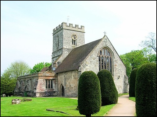
The Church at Rowington.
11.Follow path through churchyard to main road. Cross road with care and go left and immediately right (on a bend) down lane – signposted as Footpath/bridleway - and in a few minutes the Grand Union canal will be reached.
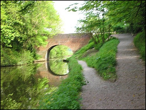
Looking back at reflections on the Grand Union Canal.
It was at this point we joined the waterway.
Chris and Annis - Note the canal tow path at this point is much improved.
To see how it was see the picture of Chris at the same point on the 2005 Walk.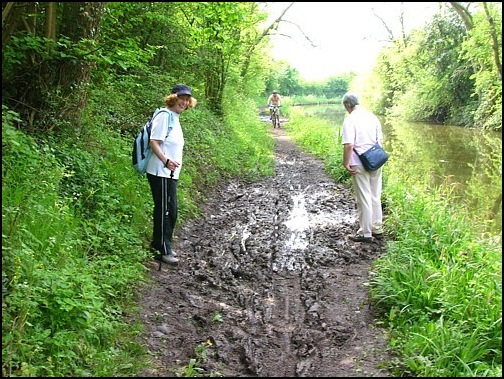
But no improvements had taken place further along the tow path.
Annis smiles at the camera while Chris contemplates the best way to cross the quagmire.
Nearing the Tom O' the Wood Public House.
12.Cross the bridge over canal and turn right to follow tow path to Bridge No 63 by the Tom O' the Wood Public House. Leave canal, turn left and soon after turn right into Dicks Lane. Follow lane, which goes under a railway Bridge before reaching the Stratford on Avon Canal.
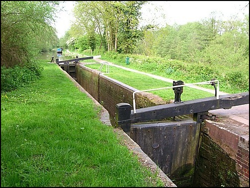
Locks at the point we crossed the Stratford on Avon Canal.
13.Cross bridge and follow track away from canal. At T junction of paths turn right and follow track. When farmyard is reached continue ahead and at meeting of five tracks continue ahead taking main track/lane to left of farmhouse.
Pleasant walking immediately after crossing the S on A Canal.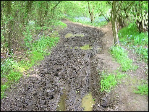
But a little further on we were greeted by more mud.
14.Follow lane (Brome Hall Lane) to main road and then turn left to Lapworth Village Hall.
The maps used for this walk were the OS Explorer maps 220 and 221.
To see a copy of the afternoon route that can be easily printed click here
I think everyone who took part in the walk(s) enjoyed it. As stated previously the weather was good, the scenery interesting and varied, and as always the food, both at lunchtime and at the end of the walk, was excellent. A big thank you must to the Lin and Joan for their culinary endeavors; everyone loved the cakes. Thanks also go to Jeff for arranging the venue etc.
As the people walking were fewer than last year it maybe that the money from sponsorship will be less than in some previous years. However, it is hoped that absent walkers, if they have not already done so, will sponsor the walkers who were there on the day.
It seems that everyone had a very enjoyable time, and with such a good venue and with such enjoyable walking I believe there is a strong possibility we will return to Lapworth for a future walk.
Cancer Research Walks Main Page.
Lapworth (Kingswood) Walks Main Page
Top of Page