The Great Oswaldtwistle Walk
The Great Oswaldtwistle Walk, which is now in its 15th year, is organised by the Oswaldtwistle Civic Society and participants have the choice of walking 11, 15 or 21 mile routes, all of which visit the high moorland to the south of Oswaldtwistle, and, like so many challenge walks, is open to both walkers and runners.
Greg and I decided to “do” the 15 mile route, so soon after 8.30 a.m. on the 13th I was paying my £5.00 fee to one of the officials at the St. Mary's Parish Centre, (previously the Oswaldtwistle Weavers Hall) in Lock Street, the starting point of the day's trek. Then it was outside onto the road and at 9 o’clock the lady mayor started us off.
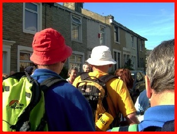
A colourful bunch of walkers waiting for the "off".
I had studied the route details beforehand and although they were very good, we did take a wrong turn about a mile from the start but, realising the error, retraced our steps and soon were following, and then becoming part of, a group that obviously knew the way. Initially, after leaving the town behind we went uphill heading towards the pub near Rams Clough on the Haslingden Road. However, before we got there we turned north east and enjoyed a steep ascent before turning left at the road at the top of this climb. From this high position we enjoyed the views before we reached our first check point to the west of the Green Haworth Golf Course (checkpoint 2 – GR 762236) a couple of minutes later. The distance of about 2.5 miles we covered in 5 minutes less than one hour. Yes we were not quite up to a mile every twenty minute pace, but we had done a slight “detour” and the route had been quite steep.
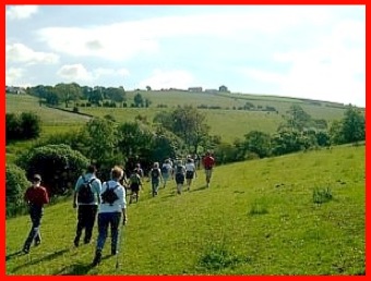
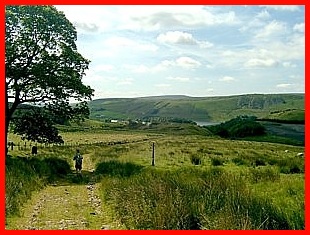
Walking across the hillsides to the south of Oswaldtwistle
on route to our first checkpoint.
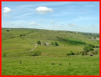
Looking back at part of the route we had taken from
just before the first checkpoint at Green Haworth.
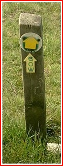
It was at this point that I realised that the permanent GOW signs that I kept seeing were for the Great Oswaldtwistle Walk. They certainly made navigation a lot easier and reassured us that we where on the right route.
Walking was easier now. We went left along the road (southwards), went straight on at the T junction and uphill along a track that passed close to Elm Tree Farm. However, having passed the farm on our right, the track became a boggy, barely defined, path and more difficult to walk as we went uphill to a small col where we would meet the Rossendale Way. Once over the col it was downhill to the next checkpoint, (checkpoint 4 - GR762236).
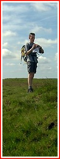
Greg approaching first of the 2 checkpoints on the Rossendale Way.
As we neared the checkpoint we were told that we were about 8th. Although I don’t know the exact figure, I think there were over 40 taking part in the 15 mile walk, so I was quite pleased. However, I don’t think Greg was too happy as he was really going fast but had to stop every so often, mostly on top of the ascents, to wait for me to catch up.
As we continued west along the Rossendale Way, I occasionally looked behind and saw the group we had left fading into the distance and by the time we had completed our entire route along the Rossendale Way and reached the next checkpoint (No. 7 - GR 733235) no walkers were in view behind us. It was now 11.30 a.m. We had been walking 2 ½ hours and completed almost 7 miles and with most of the ascents behind us we started to speed up a little.
Leaving this checkpoint, we crossed the road (the Grane Road) and took a path downhill through a field until we reached a small road. Here we turned right and went up the road for about 150 yards before turning left off it. This path took us past some ruins before going downhill. At the bottom we crossed a stream, climbed over a small rise and went over another stream via a small bridge. Then it was up hill passing a number of other walkers who had stopped to enjoy a break on the hillside. But we continued on and about ten minutes later we were entering the village of Belthorn.
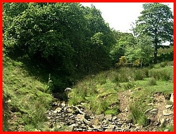
A stream we crossed on the way to Belthorn.
From the outskirts of Belthorn the views towards Darwin were impressive and we had a really good view of the Jubillee Tower on the hillside above Darwin, which Anne and I think looks like a space rocket.
There was a checkpoint (No. 8) in Belthorn at the Dog Pub (GR 716248). The lady taking our numbers and handing out water and biscuits on hearing my voice said “You’re not from ‘round these parts?”. Having replied and had a pleasant conversation we walked on. Both Greg and Ian, number two son, who has visited Oswaldtwistle, said that this is quite a normal occurrence.
Greg walking through Belthorn.
Leaving the pub behind we continued down the road and turned right through a farm yard with a number of dogs. Now neither Greg nor I are mad about dogs but these were tied up so we just gave them a wide birth and ignored their barking. However, I had wandered a little too near them and suddenly one, which had previously been lurking in the background, raced towards me, barking and snarling. However, no blood was spilt as a couple of feet from me his leash came into play and jolted him back. We were glad to leave that farm yard behind.
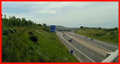
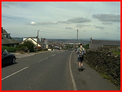
Crossing the M65. The hill in the distance is the location for
the Darwin "Space Rocket". You may just be able to see it.
Having crossed the Grane Road again, we crossed more fields and then crossed the M65 via the road between Guide and Oswaldtwistle. We then went northwards to the west of the motorway towards the last checkpoint. Just before reaching this we were overtaken by two runners; in fact I think they were the only two runners doing the 21 mile route. Almost immediately afterwards we did some overtaking passing two ladies on the 11 mile walk who kindly let us pass along a very narrow overgrown path.
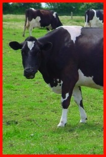
So the last checkpoint (No. 9 GR 714272) was reached where more water was drunk and more biscuits were devoured. It was then along a very pleasant track (still with the motorway on our right), right at the next road, left (before the motorway was reached), and along a track until we reached a field of cows. Most of the cows were congregated around our exit stile and they did look menacing. So we got over a low barbed wire fence into the adjacent field to be confronted by a horse that had been lurking in the shadow of some trees and bushes. Neither Greg nor I are any keener on horses than dogs or cows, particularly when this one started tripping across the field to see us. Greg, being young and fast, was able to exit the field onto the adjacent road very rapidly, but I wasn’t far behind.
We arrived at Oswaldtwistle Weavers Hall at just after 1.45 p.m. and, although it does not appear on our certificates, we were told our time for the walk was 4 hours 49 minutes. I was very pleased with this, although I think Greg would have done it considerably faster without the burden of me. Then we were surprised to find we were the 2nd and 3rd to finish the 15 mile route. Maybe if we hadn’t gone the wrong way at the beginning we might have been 1st and 2nd. But who cares? It had been a great day. The weather and scenery had been excellent and we had really enjoyed it. So now it was back to Greg’s for a nice cold beer.
The area of the Great Oswaldtwistle Walk is covered by the Ordnance Survey Map No. 287 for the West Pennine Moors, which includes the areas of Blackburn, Darwen and Accrington.