Cancer Research UK Walk 2007
This year the route generally went south from Bubbenhall via Wappenbury and Hunningham to the Stag Inn at Offchurch for a mid walk refreshment stop. From here the route continued southwards to the nearby disused railway line, which was followed to the Grand Union Canal. On reaching the canal it was followed westwards through Leamington Spa, over the Railway Line and River Avon. The canal was left at Bridge 49 (Coventry Road) - although it was noted that certain walkers used earlier exit points from the canal - and from here the Centenary Way was followed into Warwick.
The route details are below (in black) interspersed with comments, pictures etc.
The route of the walk is covered by the Ordnance Survey Explorer Map for Coventry and Warwickshire - No. 221.
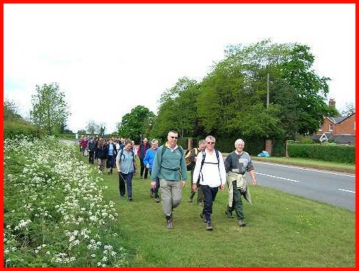
Jeff, front centre, leading the way along the A445 to Paggetts Lane
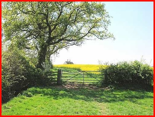
1. Leave Bubbenhall via Paggetts’s Lane (Grid Ref 364 723), which is located to the east of the A445 just north of the main road into the village.
Along Paggetts Lane
2. In about half a mile take the left hand fork in the lane and continue past Shrubs Lodge (on the left). Soon after (about quarter of a mile) the entrance to Wappenbury Wood is reached.
Bright sunshine near Wappenbury Wood.
3. Continue along the path (Nunwood Lane) ignoring the wide entrance on the right into the woodland. Go past a metal barrier with Shady Acres on the right and take the path into the wood. (Do not confuse with the lane to the left of the path)
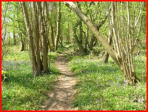
As Wappenbury Wood is closed to the public on Wednesdays and Saturdays. It was not therefore possible to route the walk through the wood. However, if anyone has the opportunity it is well worth a visit.The above photograph was taken 19th April 2007 when bluebells and other Spring flowers were in bloom.
4. When the path forks take the left path and, 200 yards further on, go through a gate and head slightly left across two fields aiming to the left of a white building. Soon the road between Weston under Wetherley and Princethorpe is reached.
'go through a gate and head slightly left across two fields
aiming to the left of a white building'
Crossing the road between Weston under Wetherley and Princethorpe
5. Cross the road and take the path to the left of the farm buildings. The path goes downhill into a field.
Walking downhill having crossed the Weston under Wetherley to Princethorpe Road
6. At the end of the field go through the gate and immediately right, through another gate, along a waymarked path (indistinct) with a hedge on the right and pass through a gate. Soon after a gate on the right is reached (waymarked). Go through this and then left to the road at Wappenbury.
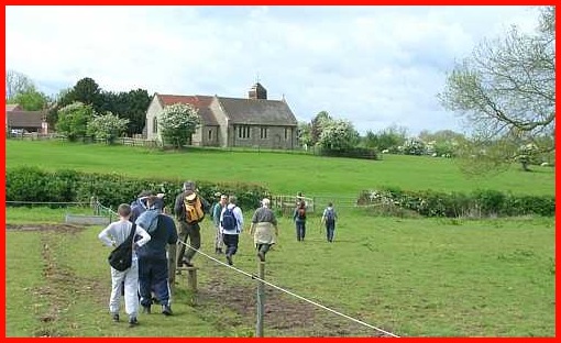
Approaching Wappenbury Church.
7. At the road turn left and shortly afterwards take the right fork in the road towards church (St John the Baptist). Take the right fork in front of the church and in a few yards take right turning (waymarked).
8. In about 100 yards a gate will be seen on left. Go through gate and take downhill path towards the bridge over the River Leam, which can be seen at the bottom of the hill. Cross the bridge and follow the obvious path soon going along field headlands, with hedge on right, to the road at Hunningham.
The bridge over the River Leam. Unfortunately on the day of walk the waters of the Leam were very murky. It was therfore not possible to see the trout that live in the water, many of which are over a foot long.
Walking between the bridge over the River Leam and Hunningham.
9. Turn right and walk diagonally across the T Junction to a right of way. Follow the right of way through a field (there may be horses in it) and enter another field – the Church at Hunningham will be seen directly ahead of you. Here, ignoring waymark, turn right to the river and follow it downstream (left).
Entering the field with horses in it at Hunningham. However, this young walker, like most, did not seem too concerned about walking through them.
Leaving the "horse field" with the church at Hunningham ahead.
Anyone concerned about walking past the horses should follow the road towards Offchurch. After reaching the second minor road on the right (about a third of a mile from T junction) turn right down this road. Immediately on the left a right of way sign will be seen. Follow this which will bring you to the stile mentioned in 10.
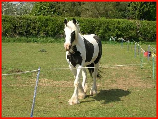
One of the horses that had to be circumnavigated on this part of the walk. As it turned out the horses were very docile and there was no problem going through them. However, I am aware of two people, although there may have been more, who chose the alternative route.
10. Follow the line of the path when it leaves the river and soon a third field will be reached. The entrance to this field is via a stile – N.B. the area around stile can be very muddy. Cross the stile and continue forward, keeping to the right of the hedge.
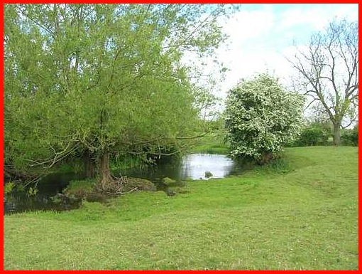
May Blossom and the River Leam
11. At the end of this field the river will once again be seen, also a yellow way mark sign. Follow the direction indicated by the sign and go up a slight rise into another field – the fifth field since leaving the T Junction at Hunningham.
It was at about this point that the first real rain of the day was experienced. However, it was only a shower but did necessitate the wearing of waterproof coats for a brief period.
12. Enter the 5th field and after about a quarter of a mile at a sign, where the path forks, take the left fork, which goes away from the river. Walk across field and continue following the obvious route which goes to the right of some farm buildings – ignore path coming in from the right and farm track to the left.
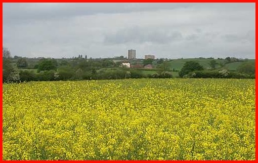
Dark clouds, rape seed oil and the flats at Lillington as seen to the west of our route
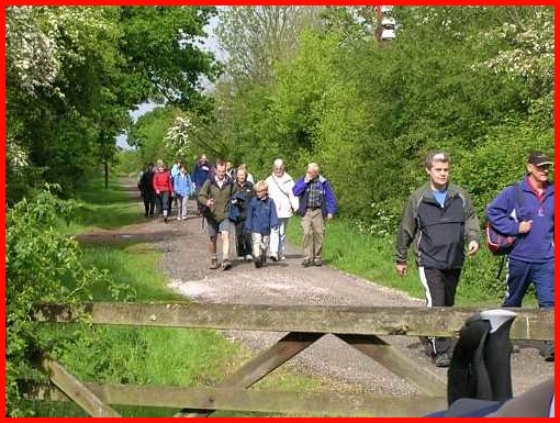
13. Having passed the last building continue forward - wire fence on the left – and at end of field go through a metal gate and through a woodland strip.
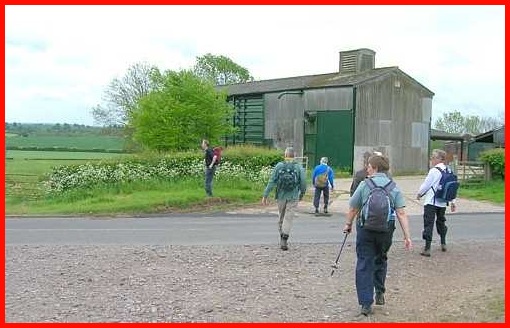
14. On leaving the woodland continue in the same direction keeping to the left of a hedge and follow obvious path along field headland to Manor Farm. Follow right of way between farm buildings and cross track/lane into field. Continue ahead to road and the Stag Inn.
The path through Manor Farm
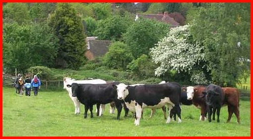
And just before the Stag is reached you are confronted by cows.
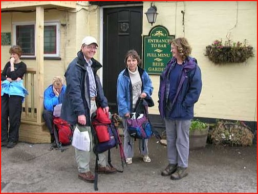
Stag Inn Lunch Stop (approximately half way)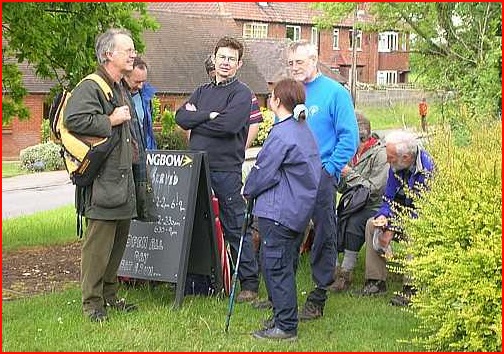
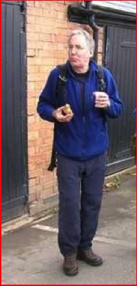
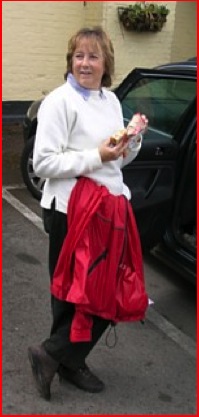
The lunch stop at the ‘Stag’ was an opportunity to rest, meet up with other walkers and enjoy food and drink courtesy of Jeff's wife Lin and friend Joan.
Thanks go to the Stag Inn at Offchurch for allowing the walkers to partake of their facilities.
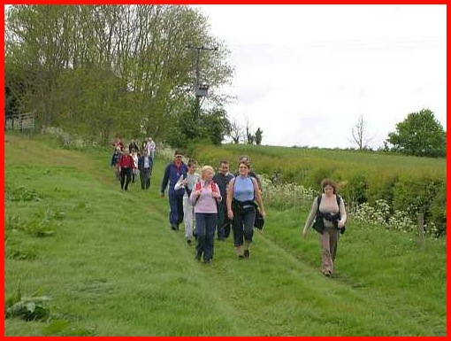
15. On leaving the Stag, turn right and soon after, having passed the road on the left to Hunningham, take the ascending path on the right which goes past Nine Hills Cottage. Enter field and turn right. Follow path uphill towards trees and in less than a quarter of a mile a road is reached via a gap in the trees. Here turn left and soon after, where it joins the road from Radford Semele, cross the main road and take the obvious path downhill to the disused railway line.
When I, along with others, left the Stag the weather was fine - or at least it wasn't raining - and wet weather gear was stowed in rucksacks. However, within 5 minutes spots of rain started to descended so waterproof coats were soon put on and I was hopeful that this protection would be enough. Unfortunately the few spots became more frequent and larger and by the time we were half way along the railway track, now a cycle way, it became torrential. So we moved as quickly as possible to gain shelter under the old railway bridge over the canal. Legs were dried as much as possible, overtrousers were then put on and we continued on our way
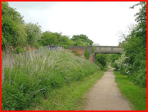
Looking northwards along the disused railway line.
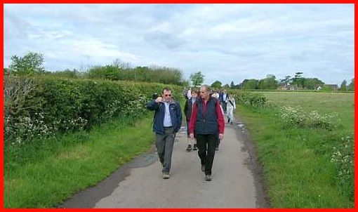
16. At the railway line turn right and follow the track to canal which is reached via a steep descending path.
17. At the canal turn right and follow the canal into Leamington - N.B. Bridge 41 (Tachbrook Road) is about 2.3 miles from the start of Canal section.
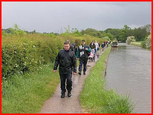
Walking along the canal - nice weather for ducks.
18. Continue along the canal past the Moorings Public House before going under the Myton Road Bridge, over the Railway Line and River Avon (ignore the path down to the River Avon) past Tesco’s (on other side of canal), under Emscote Road Bridge and onwards until the Coventry Road Bridge is reached (Bridge 49) where the canal is left. – N.B. this point is 2 miles from Bridge 41.
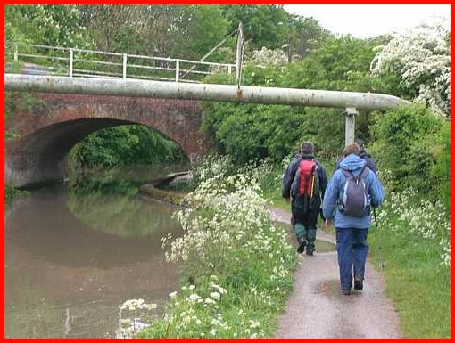
Approaching the Radford Road Bridge.
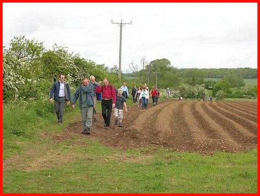
A couple of walkers about to be overtaken.
19. Turn right over the Canal Bridge and continue towards Warwick. Just before the Railway Bridge is reached turn right along a path and in approximately quarter of a mile take the path left, under the Railway Bridge and uphill with the WCC Car Park on the right. Cross over Cape Road passing the Police Station on the left and turn the corner on right to the Staff Club.
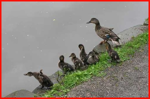
Ducks, who seem to have enjoyed the weather
As this year's walk was shorter than last year's and because of the inclement weather no one lingered, which meant that walkers arrived at the Staff Club earlier than expected. Thanks therefore not only go to the Staff Club for once again allowing Cancer Research UK use of the facilities but for opening much earlier than planned to accommodate the walkers. In addition a big thank you must go to Lin and Joan, who provided refreshments at the Stag and the Staff Club.
A big thank you also goes to all the people who did the walk and their sponsers.
Thanks to them £3523.90 was raised, again beating the previous record total.
Cancer Research Walks Main Page.
Top of Page