Kinver, The Million and Enville
16th February 2004
Four or five years ago with Mick, Larry, Peter and Ray I had a very enjoyable walk in the area of Kinver, which is located in South Staffordshire. I had wanted to revisit this area (do this ramble again) so I was delighted when Larry invited me to do a walk with him and his brother Ken and it was decided to revisit Kinver.
 We arrived at Kinver at 10 o'clock and Larry soon had his car safely parked in a municipal car park in the centre of the town. While joking about how the car park would be viewed favourably by Mick - it was free - boots were put on and soon we were off. But wait, Larry had to mark the car’s location on his GPS so he could find his way back to it later in the day. I thought this was unnecessary as this walk was one of Larry's favourites. He’d done it six or seven times already.
We had walked about 100 metres along the main street when Ken, who had also done the walk a few times, said 'Larry, I think we are going the wrong way' and we were. So we turned around and walked back past the car park in the right direction. Maybe that GPS would be needed after all!
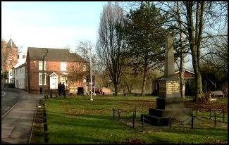
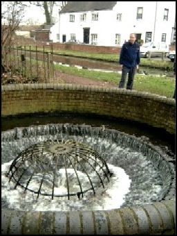
 Soon we passed a war memorial and immediately took a track that went right towards the local British Legion Club and a miniature railway. Larry took us to see the railway before we got back on route passing the British Legion building on our right.
The track, soon met up with the River Stour, which accompanied us on our right as we passed through an equestrian centre before reaching a bridge where we crossed the river. There was a brief discussion about whether we should cross the river at this point and we were about to consult the maps when we discovered that Larry had left them in the car. However, I don't think I should say much about forgetting things as the last time I was walking with the boys I forgot my overtrousers and it rained all day! I now have a spare pair of overtrousers. Could it be our advancing years are affecting our memories?
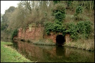
 So over the bridge we went and within 100 metre we turned left along a footpath and in a few minutes we reached the Staffordshire and Worcestershire Canal and turned left along the tow path. It was at this point that Ken informed us that according to Ray Mears, the famous television survival specialist - who goes everywhere with a camera crew – whenever walking close to water you should always have the chest strap on rucksacks undone. The logic of this being that if you should fall in it would be easier to remove your rucksack and you'd be less likely to come to a watery end.
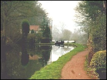
 This is a lovely stretch of canal, with some pretty little bridges and banks carved into the sandstone and on our left the River Stour meandered in the meadows below. 'Twas pretty idyllic. The only disturbance being cyclists who would come up behind us and either cough, rattle the gears on their cycles or make their brakes squeak to let us know of their existence and their urgent need to get passed us. I think it would be better if they had bells or some other means of giving warning of their approach. Maybe they had seen Ray Mears on television and in view of this have not equipped their cycles with appropriate warning apparatus in case it should frighten a walker with a chest strapped rucksack, who jumps the wrong way, which results in a drowning fatality. Doubtful, but it’s about the only reason I can see why people on bikes don’t have bells to give walkers a proper warning.
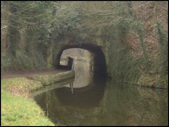
 After a couple of miles of walking the tow paths, admiring thescenery and going under numerous bridges, we came to our exit point off the canal at Prestwood Bridge (number 34). Here we turned left along a track away from the canal. Within about a ¼ of a mile a lane was crossed and we walked uphill along a sandy bridleway into a wooded area known as the Million. Why Million? I’ve no idea. Maybe it’s because someone once said there were a million trees there. I doubt that there are that amount, but there are still quite a few, most being tall fir trees. Quite spectacular but as Ken stated “it would be nice to see more deciduous”.
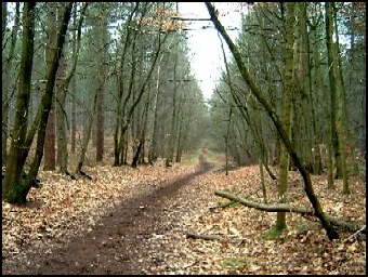 We were pleasantly surprised with the path through the Million. We had expected the going to be more difficult after recent rains. Although there were some muddy areas, thanks to the sandy soil, and efforts to make the pathways (bridleways) acceptable to horse riders the walking was easier than expected.
The route though the Million is very straight forward – you generally go in a westerly direction until you reach a wide lane. Care is needed here as this roadway, where you turn right, has no footpath and was quite busy.
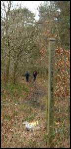 Having walked about a ¼ of a mile along this road (north) we took a footpath on our left and continued initially through woodland and then through open countryside going north west until we reached a small community called Blundies. At the T junction we turned left and followed the road to the most important part of the walk – a visit to the Cat at Enville. This is a lovely little country pub. I remember when I visited previously most of us consumed “Balti Breakfasts”. These were large round nan breads, which just fitted on our plates. These were split in two with sausage, egg, bacon, beans, and mushrooms as a filling. I thought them quite delicious, especially when washed down with pints of honey tasting Enville Ale. I can’t remember how many pints I had that day, but I do remember walking back to Kinver was harder than I had anticipated. I think along with others I may have been wobbling a bit!
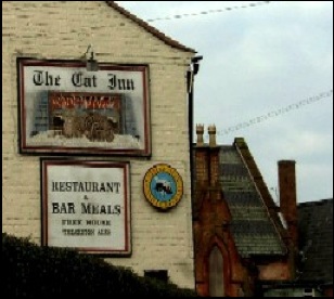 Today, however, was a Monday and unfortunately on this day it was sandwiches only. However, Ken was able to persuade the bar maid to supply a big bowl of chips. All were very enjoyable, particularly with a couple of pints of the honeyed brew.
Around the corner from the Cat are two white gates, which, besides being the entrance to Enville Hall, were the start of our path back to Kinver along part of the Staffordshire Way. So our route back to the car was fairly straight forward other than nearly going the wrong way at Rocky Hall. When we got to the road by this farm there was a temptation to go left, when we needed to go right and then immediately left uphill along a footpath that went in a south easterly direction.
 We then strolled down hill into Kinver and made it back to the car without the need of GPS navigation.
The walk would be, according to Larry, 8 or 9 miles in length, although it seemed less, probably because of the enjoyable banter and conversations that always seemed to be going on.
If you intend to do this walk you will need two OS Landranger Maps, numbers 138 and 139. You should also note that the Cat, which was the only pub I was aware of that closed on Sunday, is now open every day of the week. Hooray.
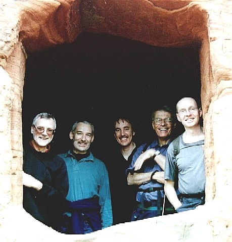
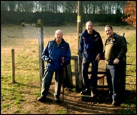
‘Seems very bad visiting Kinver and not visiting the houses built into the local sandstone or going on to Kinver Edge. However, I did do this the first time I visited into this area and just to prove it here is a photograph of the the "Boys" looking from the window of a cave house.
We had walked about 100 metres along the main street when Ken, who had also done the walk a few times, said 'Larry, I think we are going the wrong way' and we were. So we turned around and walked back past the car park in the right direction. Maybe that GPS would be needed after all!
The track, soon met up with the River Stour, which accompanied us on our right as we passed through an equestrian centre before reaching a bridge where we crossed the river. There was a brief discussion about whether we should cross the river at this point and we were about to consult the maps when we discovered that Larry had left them in the car. However, I don't think I should say much about forgetting things as the last time I was walking with the boys I forgot my overtrousers and it rained all day! I now have a spare pair of overtrousers. Could it be our advancing years are affecting our memories?
The route though the Million is very straight forward – you generally go in a westerly direction until you reach a wide lane. Care is needed here as this roadway, where you turn right, has no footpath and was quite busy.
Around the corner from the Cat are two white gates, which, besides being the entrance to Enville Hall, were the start of our path back to Kinver along part of the Staffordshire Way. So our route back to the car was fairly straight forward other than nearly going the wrong way at Rocky Hall. When we got to the road by this farm there was a temptation to go left, when we needed to go right and then immediately left uphill along a footpath that went in a south easterly direction.
With us on this part of the walk was Bill. We met Bill, a semi retired mechanical engineer who used to live in this area, just inside the aforementioned white gates where he had parked his car. There was plenty of conversation on this part of the walk with a lively exchange of views on numerous subjects, mostly relating to local government and politics in general. It became fairly obvious early on that Bill was more right wing than the average local government officer. We said farewell to Bill on the outskirts of Kinver, and Ken remarkedit was probably a good time to say goodbye as differing political persuasions could have resulted in the discussions getting more intense – or words to that effect.
The walk would be, according to Larry, 8 or 9 miles in length, although it seemed less, probably because of the enjoyable banter and conversations that always seemed to be going on.
If you intend to do this walk you will need two OS Landranger Maps, numbers 138 and 139. You should also note that the Cat, which was the only pub I was aware of that closed on Sunday, is now open every day of the week. Hooray.
‘Seems very bad visiting Kinver and not visiting the houses built into the local sandstone or going on to Kinver Edge. However, I did do this the first time I visited into this area and just to prove it here is a photograph of the the "Boys" looking from the window of a cave house.