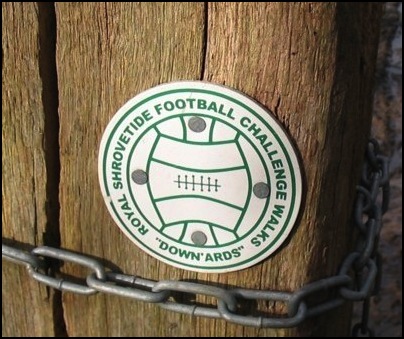
Ashbourne - Down'ards Walk
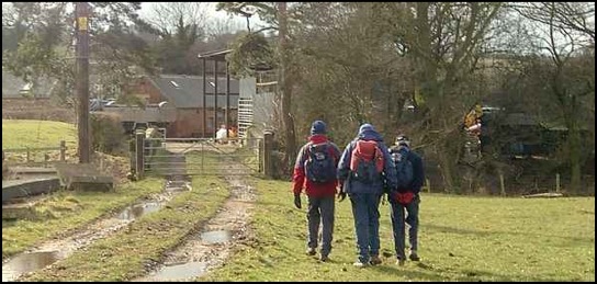
Answer: Larry has a book he sent away for, about two anytime challenge walks based on Ashbourne that commemorate the Shrovetide Football Game that takes place in the town every year when two teams, the Up’ards and the Down’ards, demonstrate their skill, strength and foolhardiness chasing a misshapen football in and around the town; with Larry and me were Mick and Peter, who like me were up at some unusually early hour – well it was for me - to do the Down’ards Walk. This is the shortest, being just 11 miles.
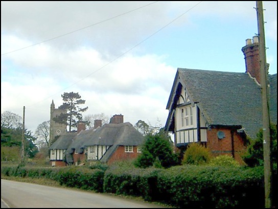
The walk should really start from Ashbourne, but as it was market day the town was likely to be busy and parking – particularly free parking, which Mick is very keen on – was likely to be at a premium. So as we neared Ashbourne a decision was made to park in one of the villages that the walk goes through.
Larry had overlaid the route on the OS Map for the area, and had also brought with him the book with the extremely detailed route information, so the chances of taking wrong turns were minimised.
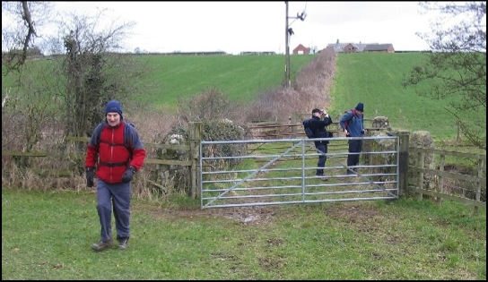
Now there is a set procedure on almost every walk we do. One of us comes up with an interesting walk and Larry will get maps sorted out. Often at this point I’ve had nothing at all to do with the walk. The day arrives, we get to the start of the walk, boots and rucksacks are put on, and then someone thrusts a map into my hand and I’m being asked which way to go. So was it my fault that when we reached the village duck pond, when I was trying to take a photo, that I gave the wrong directions?
Map details of walk click here
However, on the plus side we noted that there were, along the way, little round markers to show the route. Although, as we have found on previous walks, the very time you are not sure of the way the markers become none existent which is the very time such information is needed.
Osmaston to Clifton – Distance 3.75 miles
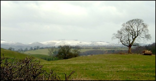
This part of the route initially goes through Osmaston Park. It’s a bit up and down but it’s easy walking although in parts it was very muddy. Just after 9.30 a.m. we reached Wyaston, which we had passed through an hour or so earlier when we were looking for a parking spot. It looked a very pleasant little village but we were all more interested in the views north of the southern extremities of the White Peak which was living up to its name as it was covered by a layer of snow.
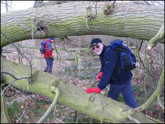
We were making good time as now most of the walking immediately north west of Wyaston was along a very pleasant mud free country lane, until the Ashbourne to Lichfield Road (A515) was reached. Once over this, having passed through some scrubby woodland the leading walkers, Mick and Peter, continued westwards when the route was actually north. So having examined the map and admonished Larry (again) for not bringing the route details with him we went northwards. Paths here were not very obvious and as I was now the one with the map in my hand I too got admonished for leading our merry group too far east of north, but all was forgiven as we found the route, lost it again – the route marker was hidden behind a fallen tree - wished we had the route details and navigated through a field of cows before reaching Clifton.
It was now 11 o’clock, so we took advantage of a lych-gate, complete with seating, outside the village cemetery to enjoy hot drinks and food. Unfortunately failing batteries prevented me taking a picture of our picnic spot. ‘Decided I must buy some when we reach Ashbourne.
Clifton to Ashbourne – Distance 1.75 miles.
Leaving Clifton we passed the Down’ards “Goal” of the Shrove Tuesday Ball Game before heading towards Doles Farm over a large very windswept, field. Once past the farm we entered another windswept field – it was a bit chilly - and it was a relief to reach the shelter of the outskirts of Ashbourne, when the sun came out and the temperature went up a few degrees. Much better.
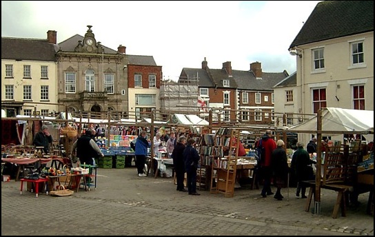
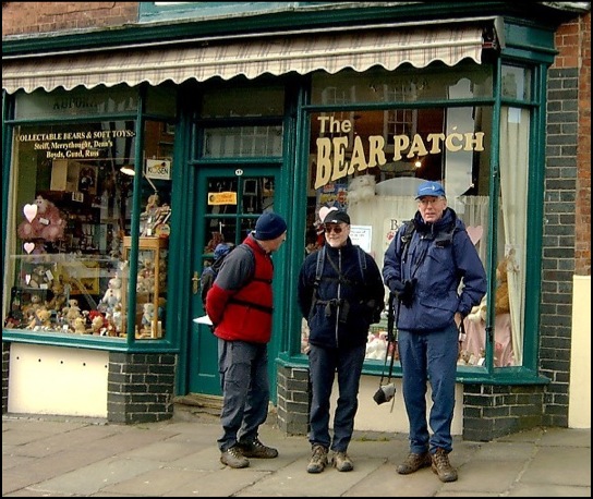
The market was reached and we spent 10 or 15 minutes having a wander round and I was able to purchase some batteries and take a photo of Mick, Peter and Larry before we started the next leg of our hike.
Having now read the full details of the walk, I realise that the proper start finish point is in the Shawcroft Car Park, located behind the buildings to the south of the Market, and I suppose we should have visited this location to have done the circuit according to the “book”. But I’m not going to be too concerned about that.
Ashbourne to the A517 south of Sturston Hall – Distance 2 miles
Leaving Ashbourne our route was initially north east along pavements before, having passed Parkside School and Boothby Meadows School, we turned right, crossing playing fields before going eastwards for about a mile. I estimated that it should take us about 20 minutes and the map indicated we would go through 12 fields. But as so often happens you start talking, forget about the time and stop counting fields, and about where I thought we should turn south to Sturston Mill the signs had vanished. Although a sign for the Up’ards Walk was spotted, which could have made things even more confusing, we saw to our right (south) what we presumed to be Sturston Mill so we followed a farm track towards it.
It was the mill; we spotted a Down’ards sign and as we got near to it and we also spotted the Up’ards Goal.
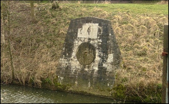
Like the Down’ards it was located facing a stream. You certainly would get wet if you scored a goal in this game. We crossed the bridge over the stream, walked through the farmyard – the Mill seems to be a farm – and headed uphill towards the A517 (the Ashbourne to Belper Road) passing Sturston Hall on our way. Important Note: at this point I didn’t have the map and as mentioned before Larry hadn’t brought the route details.
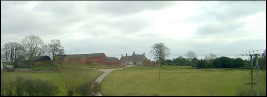
Sturston Hall to Osmaston –Distance 3.5 miles
On reaching the A517 we spotted a Down’ards sign on the other side of the road, which indicated the track went into woodland and up a steep incline. With Mick and Peter in the lead Larry and I followed until the path vanished. However, M and P continued to lead us uphill until we could go uphill no more and we followed them left until we could go left no more and so we all went left again back to the road a short distance to the left of where we went into the wood. The map was then examined which indicated when we went into the wood we should have almost immediately gone left at a crossing of paths. This would have had the double benefits of a shorter walk and less exercise for my aging knees.
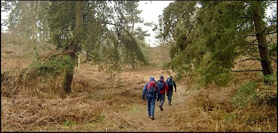
Back on the road a sign was spotted on a gateway with a Down'ards sign fixed to it and we were on the right track again as we went to the right of a farm house, past a couple of old tractors in an old shed and uphill onto Bradley Moor, which at a height of over 180 metres is one of the highest points on our walk. Here again Larry’s Book would have been useful, but with the aid of the map and compass we soon found the gap in the hedgerow we needed to go through to continue to Firs Farm, the next significant point on our route.
So having gone eastwards past the farm we needed to look for a path on the right. It should have been obvious, but Peter and Mick didn’t see it, neither did Larry or me, and as we reached a cattle grid I checked the map and realised we’d passed it. Oh no not another navigational error. Having now read the instructions I can see where we went wrong as they state …reach the right hand edge of a field boundary with a cattle grid 20 yards ahead. Now, frustratingly, turn completely around the way you came and you will see a stile in the hedge in front of you… None of us frustratingly turned round so that explains why we missed it. But we could see that after crossing the cattle grid we could turn right along a lane, and by following the lane and turning right at the next junction we would rejoin the route.
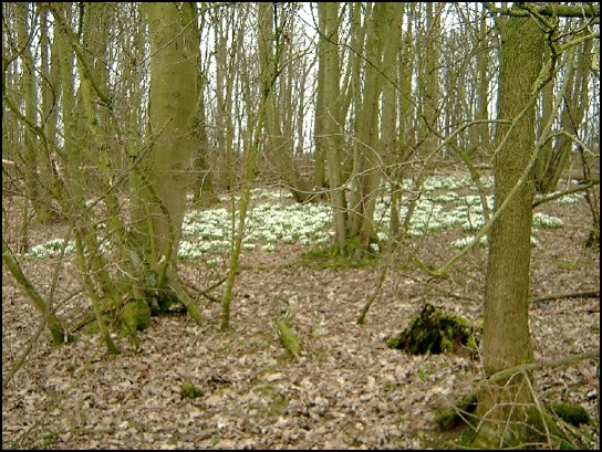
This was the last of the navigational “challenges”. Now we just followed the obvious route south west stopping for a “cuppa” just before passing the grounds of Yeldersley Hall on our left where we took the opportunity to admire the snowdrops that were carpeting large areas of the woodland.
Soon we reached Painters Lane then it was straight over the road, downhill, over a stream and then uphill into Osmaston and the circuit was completed. It had taken us 4 hours and 30 minutes. Certainly not a particularly fast time for the route but we did stop a few times etc.
I really enjoyed the walk. The countryside was varied and to visit an area I had not walked before generally makes for a more interesting excursion. In fact I wouldn’t mind doing it again, but I think the rest of the “boys” fancy the Up’ards Walk next time we hike in this area. If we do it though, I’ll make sure that Larry brings “that Book”.
If you would like to do this walk the excellent packs, which includes the book/routes for both walks, and certificates (yes Larry gave us all a certificate for completing the walk), are available from Mike Warner (who “came up” with the walks) at Redlands House, Clifton Cross, Ashbourne, Derbyshire. At the time of the walk the cost of a pack was £5.00 including post and packing with all profits going to the Royal Shrovetide Committee and towards the upkeep of the Royal Shrovetide Challenge Walks.