Cancer Research UK Walk 2006
You will note that this year we had decided to abandon the local canal infrastructure for the walk and, as this would result in the route being less obvious, I put together some directions based on my experience of parts of the route, a quick drive round the lanes that the route would cross and examination of the relevant O.S. Map. It was therefore very much a relief to find out that two of the regular walkers, Bridget and her husband Gary, had walked the route the weekend before and considered my instructions easy to follow, even without a map, and thought the scenery to be very good. However, I was concerned as it had taken them more than 30 minutes longer than my estimated timings.
The route details are below (in black) interspersed with comments, pictures etc.
The route of the walk is covered by the Ordnance Survey
Explorer Map for Coventry and Warwickshire - No. 221.
The route follows, for the most part, the Coventry Way to Kenilworth and the Centenary Way from Kenilworth to Warwick
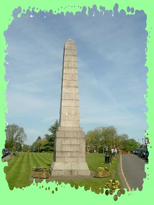
The Centre of England Monument on the Green in Meriden.
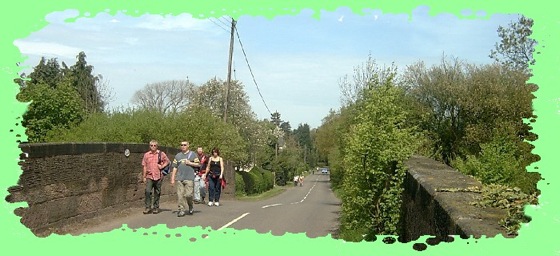
1. The walk starts from the Monument on the Green in Meriden (The Centre of England). This is approximately 1 mile from the Coventry Way which is reached by walking east along the B4102.
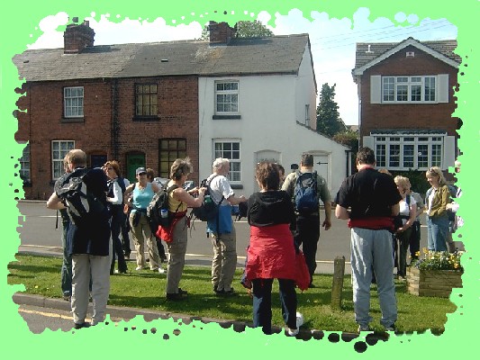
Adjusting rucksacks and enjoying the sun before "The Off"
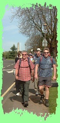
Jeff and Gary leading the way as we leave the Centre of England Monument.
2. This part of the route, which is on pavements, passes the road to Berkswell (on the right). We go right at the next turn into Church Lane.
3. Walk up Church Lane (South) and immediately after the lane bears left take the second of two paths on the right. The one you want will be marked as being the Coventry Way and at this point it is also the Heart of England Way. (Total Distance walked approximately 1 mile)
Walking up Church Lane.
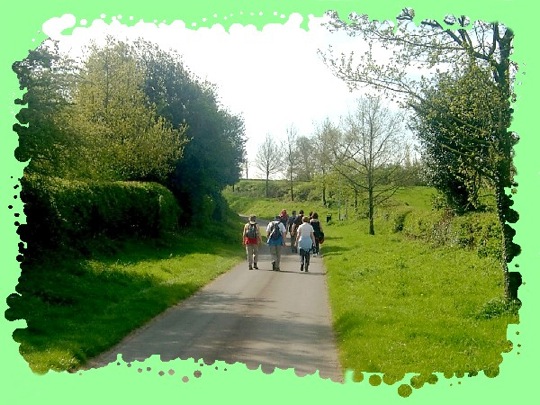
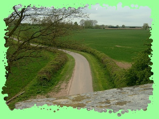
4. Follow this path southward for approximately .75 mile until a road is reached (Back Lane). Cross this and continue southwards along the track on the other side of the road.
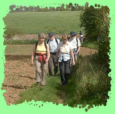
Approaching Back Lane - left to right Sandra, Jez, Sandra and John.
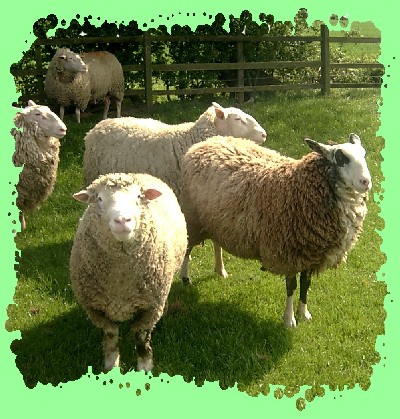
I wonder what this sheep would say if it could talk?
5. After about .5 mile, at a crossing of paths, we leave the Heart of England Way (it goes straight on). Our route goes left (east). .25 mile further on a track is reached by Hill House Farm where we go right and shortly afterwards we reach Broad Lane (Shown as Coventry Road on some maps). (Total distance walked approximately 2.6 miles)
On the Coventry Way approaching Benton Green Lane.
The leading five are Bridget, Jeff, Richard, Chris and Paula.
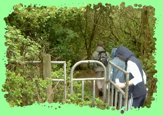
6. At Broad Lane (Coventry Road) turn right and in about 100 metres turn left into Benton Green Lane. TAKE CARE - THERE ARE NO PAVEMENTS - FACE ONCOMING TRAFFIC.
Walking along Benton Green Lane - left to right Richard, Bridget and Jeff.
7. Follow the lane for .25 mile and as the lane bends to the left follow the signs on the right indicating the Coventry Way. In .5 mile, at a crossing of paths, turn left and within .25 mile, at another crossing of paths, turn right and in approximately .3 mile the road is reached at Carol Green. (Total distance walked approximately 4 miles)
8. At Carol Green turn left and immediately right into Truggist Lane. In about 50 metres, turn left into Hodgetts Lane.. Follow Hodgetts Lane until the bridge over the railway is reached.
The Railway Bridge at Hodgetts Lane - Jeff and Richard with with Chris and Paula behind them.
9. Cross the Railway Bridge and immediately turn right along a private road, which is also a Public Right of Way. There are Coventry Way signs indicating the route.
10. Look for a path on the left, follow it and within in .3 mile the disused railway line is reached. Here turn left and follow the “track”.
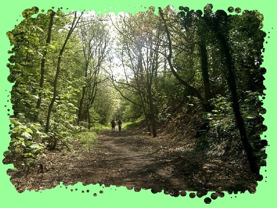
Speckled light along the disused railway track.
11. In about .2 mile, the “track”, goes under a road bridge and under another road bridge at Burton Green (a distance of 1 mile along the track).
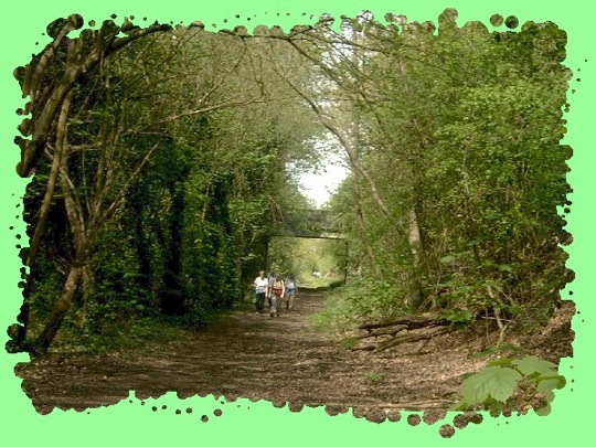
Further along the "Track".
12. In just under 1.5 miles after Burton Green a road bridge is crossed at Hollis Lane. – The bridge is easily identifiable from the white graffiti which includes “Coventry City FC” and “Viva Communista” on the left hand wall – Once over descend the steps on the right to Hollis Lane. (Total distance walked approximately 7.4 miles).
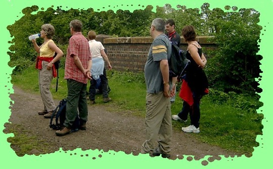
So I'm about to take this photo and suddenly it seems everyone is more interested in watching Sandra have a drink. Strange!!
The view from the bridge over Hollis Lane.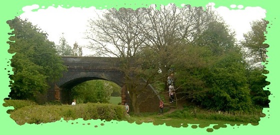
Descending off the bridge over Hollis Lane.
13. Here turn left and follow the lane for approximately 1 mile until Beehive Hill/Fieldgate Lane is reached.
14. Turn left into Fieldgate Lane (Take care crossing the road) and follow it (ignoring the turn left into Upper Spring Lane) until the traffic lights are reached. Here turn right and follow the road (High Street) towards Kenilworth Castle and the refreshment stop at the Queen and Castle Inn.
You will now have completed about 9.1 miles.
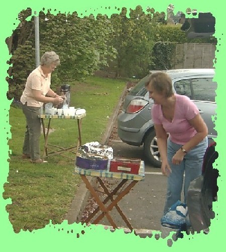
Lin, and her sister Carol, getting the food ready in the car park of the Queen and Castle for the 30 plus hungry and thirsty walkers who started striding into the pub car park at about 12.30 p.m. approximately 30 minutes earlier than was anticipated. Obviously having Bridget and Gary near the front, who already knew the way, had made a significant difference.
The lunch break signified the end of the beautiful sunny weather we had enjoyed during the morning as now the sky was getting overcast and spots of rain were being felt. So having enjoyed the excellent refreshments most of us put waterproofs on before continuing.
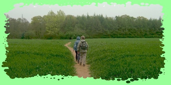
15. Follow the path to the Car Park to the left of “the Castle” and follow the signs at the far end of the car park indicating the Centenary Way, which is followed back to War wick From the Castle it is about 2 miles to Rouncil Lane (Total distance to this point is approximately 11.1 miles)
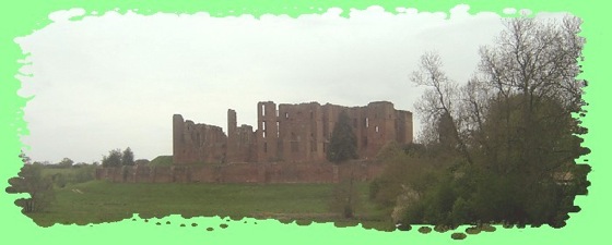
Kenilworth Castle
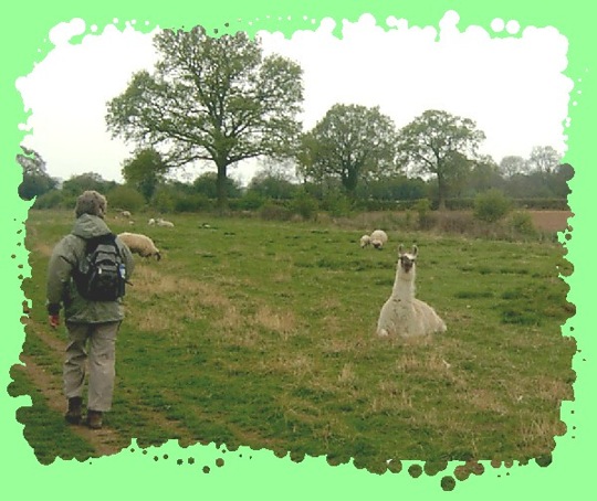
Between Kenilworth Castle and Rouncil Lane this Llama, or is it an Alpaca, was spotted in a field with a number of sheep.
16. At Rouncil Lane the Centenary Way goes left and follows the road for about .2 mile until a footpath is reached towards the end of a lay-by on the right hand side of the road.
N.B. there are right of way signs but no indication that it is the Centenary Way.
Follow this footpath across a cultivated field before entering woodland. Immediately turn right in the woodland and follow the path – the field, which you have just left, has its boundary with the woodland a few metres to the right of the path.
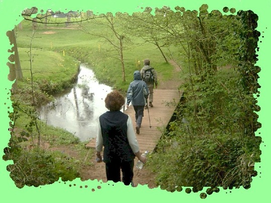
Sandra and Sandra crossing the cultivated field.
Behind the trees is the headquarters of the Warwickshire Police at Leek Wootton.
17. Soon after a golf course comes into view – The Warwickshire – and the path goes slightly left before crossing a wooden bridge over a water hazard. Cross the bridge and follow the path right – still in woodland - before going through a gate and turning left.
Crossing the bridge over the water hazard.
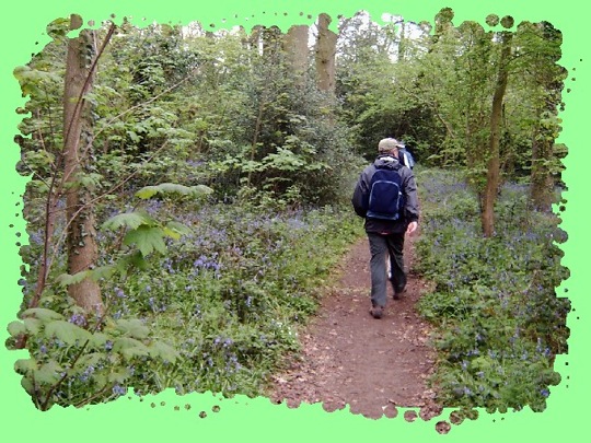
Still in the woodland, Jeff walks alongside the bluebells that were growing in profusion.
18. Having come out of the woodland continue straight ahead with a hedge on the left, which separates you from the golf course. Continue with the hedge on the left until more woodland is reached.
Entering the second woodland area, located to the east of the Wedgnock Rifle Range.
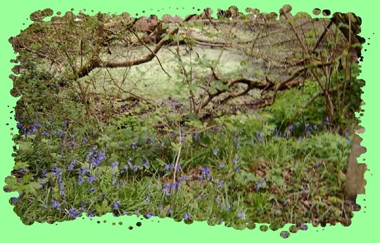
More bluebells in the woodland near the Rifle Range.
19. Having gone through this woodland, the path emerges by the side of the Golf Course - by an electricity pylon - and the route continues in generally the same direction with the hedgerow now on the right.
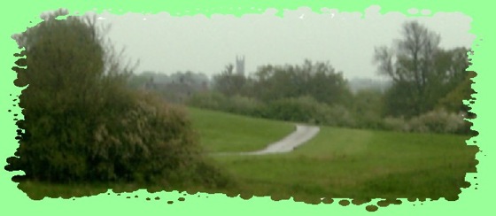
Almost home.
St. Mary's Church in Warwick seen in the distance through the drizzle that had accompanied us from Kenilworth.
20. Pass into a field and follow the obvious path anticlockwise along two sides of the field until a gate is reached, Go through the gate and follow path through field.
21. Pass a large house on the left and soon after, having crossed another field, a lane is reached. Here turn left and follow this lane over the Warwick Bypass to the Coventry Road. Total distance to this point is approximately 13.8 miles.
22. At the Coventry Road turn right and continue towards Warwick Just before the Railway Bridge is reached turn right along a path and in approximately .25 mile take the path left, under the Railway Bridge and uphill with the WCC Car Park on the right. Cross over Cape Road passing the Police Station on the left and turn the corner right to the Staff Club. Total distance 15 miles.
Having made good time during both the morning and afternoon the leading walkers reached the finishing point at the W.C.C. Staff Club in Warwick over 30 minutes before the anticipated arrival time of 4.00 p.m. But the doors were soon open and a sit down was enjoyed, accompanied by a favourite tipple, before everyone partook of the excellent spread prepared by Lin. A very satisfactory end to a very enjoyable walk.
Thanks to the generosity of the walkers and their sponsors £3,423.60 was raised. This is, by far, the highest amount we have ever raised on one of these walks. Superb.
Cancer Research Walks Main Page.
Top of Page