Buscot and Kelmscott
![]()
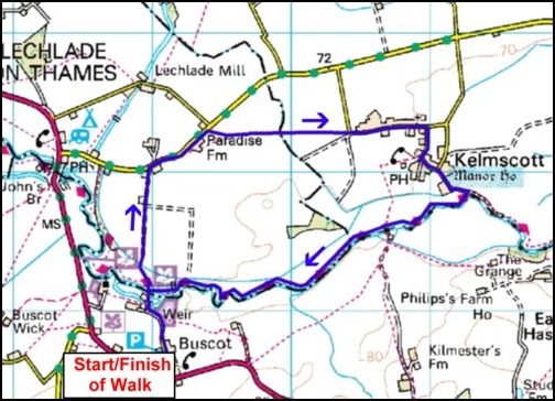
Image produced from the Ordnance Survey Get-a-map service. Image reproduced
with kind permission of Ordnance Survey and Ordnance Survey of Northern Ireland.
Like most walkers who use their cars to get to the start of a walk, I am always looking for a parking place that offers, or appears to offer, some element of security for my vehicle when I leave it to tread the paths and bridleways. On looking at the map for this area – O.S. Explorer 170 for Abingdon, Wantage and the Vale of the White Horse – I noticed a car park at a place called Buscot, just over a mile south east of Lechlade. I had never heard of this Buscot before although I was aware of a namesake (spelt with 2 Ts) on the island of Malta, which is a very pleasant spot and is noted for its gardens. It’s worth a visit if you have the opportunity to go to Malta. This Buscot, however, is noted for the River Thames and the locks and weir, which are located there.
After enjoying a very large breakfast at the hotel, Anne and I enjoyed the scenery as we travelled along mainly minor roads to Buscot and found a suitable spot in the car park, which is adjacent to the village shop/café, and very well maintained toilets.
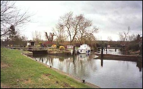
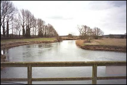
From here (map reference SU231977) it was a 5 minute walk north to the River Thames. Although the weather was kind, very mild and dry for February, except for a few anglers the area was deserted. But I would expect that in summer the place would be buzzing with visitors enjoying this very pretty location.
We crossed the river passing on the way a sign that read "Beware of Rough Ground and Mole Holes". First time I’ve seen a sign like that. Obviously a favourite place for the little velvet covered gentlemen!
Leaving the Thames behind we continued north, walking across a field and along a farm track until we reached Leaze Farm – not named on insert map (map reference 230990). From here we followed a lane north east for about a quarter of a mile and just past Paradise Farm we turned right onto the path we had been looking for. It was signposted as being the Willow Walk and we followed it amost due east along well marked field tracks to Kelmscott.
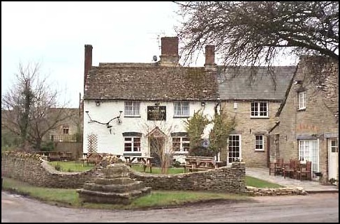
Kelmscott is noted for two important things. The Manor House, which we passed on the way back to the Thames, which my friend Graham informs me, was once the home of William Morris - and if you don’t know anything about him, and want to, I suggest you click here. However, before reaching the Manor House we passed the Plough, the village pub,. Neither of us had seen it before but it was well known to Anne as her late father’s "watering hole" many years ago when, as a keen angler, he regularly visited this stretch of the Thames.
I would certainly like to visit this village again and have a closer look at the pub from the inside. Unfortunately when we walked through Kelmscott it was too early for a mid day pint.
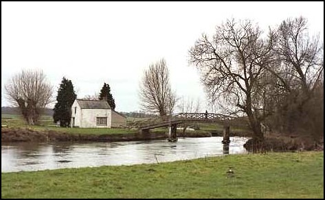
We now came to the best part of this little trek – the mile or so walk upstream on the north bank of the Thames. We only saw 2 people on our riverside stroll, an angler and another walker. It was a joy to have the views and the sound of the river, the ducks and swans, the odd splash of a fish jumping, and the gurgling of the water to ourselves. It was a glorious walk. So relaxing, so interesting and so easy with no hills to climb up or down. The nearest discernable high contours being the Ridgeway to the south.
However, all too soon we were back at Buscot, but before leaving, Anne took a minor detour so we could admire the banks of snowdrops that were making their presence known. They looked lovely as they were caught by the glimmer of the sun. Yes, it had been a nice walk.
