Marfa Ridge
For a map of the route click icon
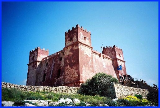
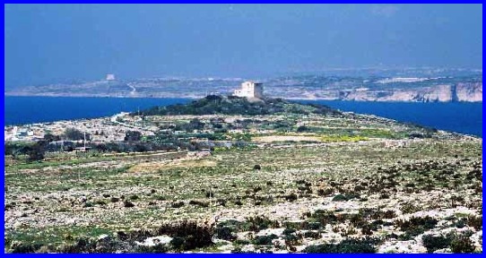
The Red Tower.
Having arrived at the Armier Crossroad, courtesy of a No. 45 Bus from St. Paul’s Bay, we decided to have a look at the Red Tower before commencing our eastwards walk of about a mile and a half to the Madonna Statue. The Red Tower was built in the 17th century as a pirate-warning lookout and, according to all the guide books I've read, the admission is free. However, having walked up the hill to reach it we found that because there was an art exhibition in the tower that a charge was being made. As I was not interested in the exhibition, I considered the £3.00 plus for the two of us to climb to the top of the tower to be a bit steep. And, as Anne considered the steps to the top of the tower to also be a bit steep, we decided to give this expenditure a miss. However, we did enjoy the views from the base of the Tower over Mellieha Bay and north west to Cirkewwa where you can "catch" a ferry to Gozo.
Going down the hill back to the Armier Crossroads we were surprised at the number of people about. And then we realised it was Freedom Day, a Bank Holiday to celebrate the withdrawal of British Forces from Malta in 1979. There were going to be more people about than we expected.
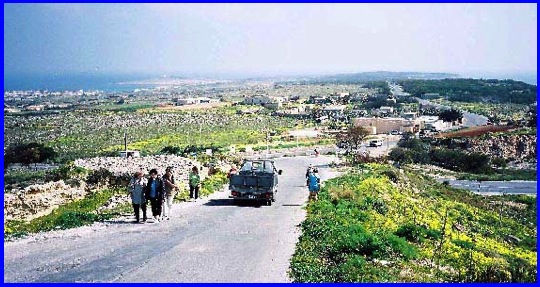
Looking across the Armier Crossroads and along the Marfa Ridge Road,
which leads to the Madonna Statue
Normally we don’t like walking along roads but this stretch, that went towards the Madonna Statue, was not very busy. Car owners may have been reluctant to use it because of all the potholes. However, we found it very pleasant with the flowers on either side of the road beginning to bloom in the spring sunshine. Initially some of the adjacent land was cultivated but as we neared Rdum il Hmar the land on our right became more scrub-like and was being well used by the locals who were enjoying Bank Holiday BBQs and picnics. We moved off the road to this area and followed coastal paths, which gave us spectacular sea and coastline views.
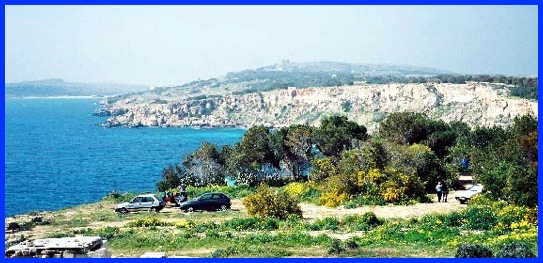
Looking back from near the end of the Marfa Ridge Road.
Picnickers, Coralline Limestone Cliffs and the Red Tower in the distance.
Soon, having done a small amount of uphill work, we came to the end of our north easterly route and reached the Madonna Statue. It was smaller than I expected but I certainly was not disappointed with its windswept location and yet more superb views. Despite the condition of the road to the statue the number of vehicles about indicated that this was a popular spot.
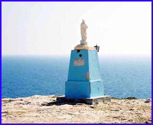
The Madonna Statute.
We now turned left and walked with the coast on our right and experienced some of the most difficult flat walking we had ever encountered. The coralline limestone in this area is more or less totally uncovered and it is like walking on hard, enlarged, fractured honeycombs. As we walked, the cliffs reduced in height and we saw a couple of fishermen trying their luck with rod and line in the azure sea. Both Anne and I fancied a sit down but we had not got cushions with us and we certainly would have needed some to make ourselves comfortable on this part of the terrain. It really was a relief to get to Ahrax Point at the end of this stretch of the walk and on to a marginally less jagged surface.
The White Tower at Ahrax Point.
Very close to Ahrax Point, which is the most northerly place on the main island of Malta, there is a very large hole in the rocks – about 80 foot long and 45 foot wide. Needless to say I approach this area with care as if I’d fallen in the only way out would have been an "exciting" swim through a limestone archway into the open sea. It certainly was an impressive piece of erosion. We then walked south west.
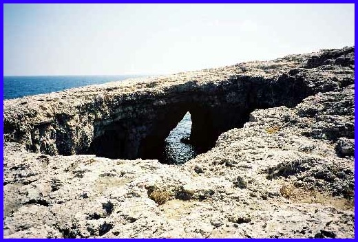
An impressive piece of erosion
By now we were getting hungry and thirsty and in need of sustenance. We passed close to the White Tower, another invader lookout point, and soon arrived at Ramla tat-Torri, which I understand in English means Slug Bay. Not a very nice name, and I wasn’t impressed with the place; It was wall to wall holiday homes, most of which resembled expensive shacks. So we quickly continued on to the Armier Bay where we discovered "Ray’s Lido" situated right on the sea edge. The lady who looked after us, Sandra, was very helpful. In no time at all she had drinks in front of us and we sat enjoying them overlooking the blue sea and the Island of Comino in the distance. Yachts were out. We could even see the Gozo Ferries steaming in and out of Cirkewwa. We both agreed that this was what a holiday should be like. So we had another drink with our Pizza (we had been very good and this was the only one we had all the time we were on Malta) and were very reluctant to leave such a lovely spot.
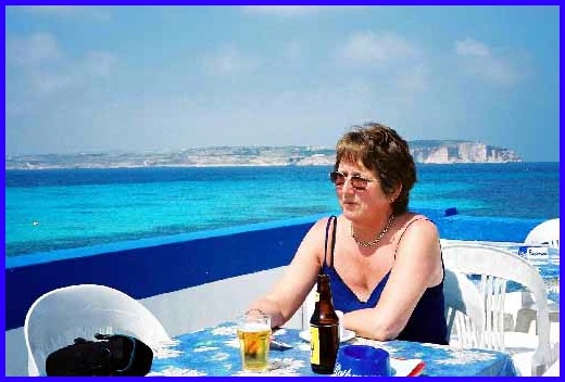
Anne enjoying the sun and a drink "Ray's Lido", with Comino in the distance.
At the south end of Armier Bay we took the main road for a 100 or so yards, and just as it did a sharp left turn we carried straight on. By doing this we were able to cut across the headland and after passing through another small bay we came to the Ramla Bay Hotel. It, and the adjacent hotel, shared an impressive location with wonderful views north westwards to Comino and Gozo. The Ramla Bay also had its own private beach. However we did feel these hotels were a little bit out of the way for exploring the rest of the island and certainly preferred our holiday base at St Paul’s Bay
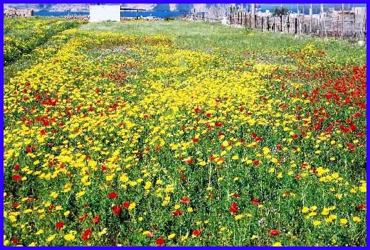
Flowers - lots of them along the path on the way to Ramla Bay.
Although we had originally intended to walk from the hotels back to the Armier Crossroads we realised that we only had to go a few yards further along the coast and we would "hit" the road between Cirkewwa and the rest of the Island. So we had an easy stroll along the road to the bus stop and waited for a "45". This meant we got back to the our hotel earlier than planned which gave us time for a cup of tea, or was it something a little bit stronger, on our balcony.